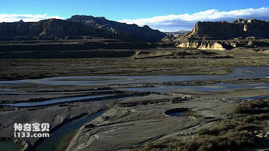
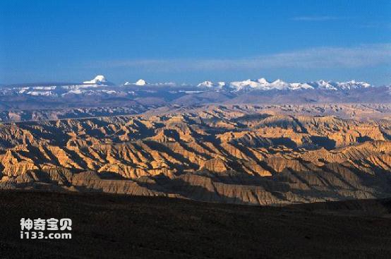
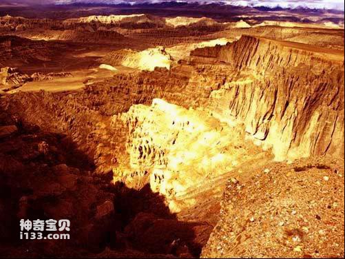
The Zada Basin is located in the Xiangquan River Basin in the west of the Tibet Autonomous Region, with an altitude of 3,700 to 4,500 meters. It is administratively under the jurisdiction of the Ngari Prefecture. The Xiangquan River is the second largest river in the Ali region and the upper reaches of the Sutlej River, the largest tributary of the Indus River. When people talk about Zada, they often think of the ruins of the Guge Dynasty, which records the rise and fall of this kingdom that lasted for 700 years. Another one that is much talked about is the Zanda soil forest. The foundation for the formation of the soil forest is the fluvial and lacustrine sediments of the late Cenozoic. It is stratigraphically named the Zada Formation. It records the history of Qinghai-Tibet in recent millions of years. The uplift history of the plateau.

Xiangquan River

Zada Basin
In terms of geological structure, the Zanda Basin is located at the contact point between the Lhasa Massif and the Himalayan tectonic belt. The Yarlung Zangbo Suture Zone passes along the northern edge of the basin, the Ayla Riju Mountains. Since the late Cenozoic, the Karakoram Fault has passed through the northern and southern edges of the Ayla Riju Mountains. The southern edge of the Zanda Basin is separated from the Tethys Himalayas and southern Tibet. Tie. The basin is about 140 kilometers long from east to west and has a maximum width of 50 kilometers from north to south. The basin is in the shape of a trumpet opening to the west. The Cenozoic strata in the basin are produced nearly horizontally, overlying the Jurassic-Cretaceous metamorphic sandstone of the basin bedrock. The exposed thickness of the strata reaches its maximum at the southern edge of the basin, about 800 meters. The lower part is composed of rapidly accumulated gravels. Sandstone is interbedded with thin layers of mudstone. The middle part is interbedded with sandstone, mudstone and marl, and the upper part is interbedded with thick conglomerate and thin layers of marl and mudstone.

Zada Basin
The woolly rhinoceros is not the only Ice Age animal that originated from the Tibetan Plateau. Other members of the Zanda fauna, as well as mammalian fossils found at other sites on the Tibetan Plateau, have shown that the unique Tibetan fauna dates back to the late Miocene period. The ancestors of the blue sheep (Pseudois nayaur) also appeared in the Zada Basin and spread to northern Asia during the subsequent ice age. The evolutionary history of the blue sheep (Pseudois nayaur) is very similar to that of the woolly rhinoceros.
In addition, molecular biologists have established the ancestral types of yak (Bos mutus) and argali sheep (Ovis ammon) in the Tibetan Plateau or surrounding mountains and their North American Ice Age animal relatives, such as American bison (Bison bison) and Canadian argali sheep (Ovis canadensis) phylogenetic connections. Yaks, which share the same large size and thick coat as the woolly rhinoceros, were also found moving north during the Pleistocene, as far north as the Lake Baikal region of Siberia.
Among the typical species of extant fauna on the Tibetan Plateau, the Tibetan wild ass is also found in Pleistocene sediments in Alaska, North America. The origin of the Tibetan antelope can be traced back to the Ku sheep in the late Miocene period in the Qaidam Basin in the northern Tibetan Plateau ( Qurliqnoria), the original type of snow leopard was discovered in the Pliocene of the Zanda Basin and spread to surrounding areas during the Pleistocene.
animal tags: yak
We created this article in conjunction with AI technology, then made sure it was fact-checked and edited by a Animals Top editor.