Going south from the East China Sea through the narrow Taiwan Strait, we enter the turbulent South China Sea. The South China Sea is the deepest and largest sea in my country and the third continental sea in the world after the Coral Sea and the Arabian Sea. The South China Sea is located at the shipping hub between the Pacific and Indian Oceans and is of great significance both economically and nationally.

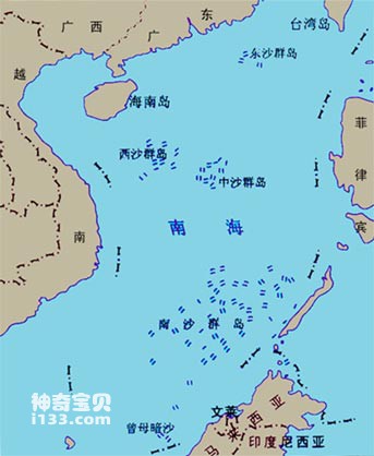
Geographical location map of the South China Sea

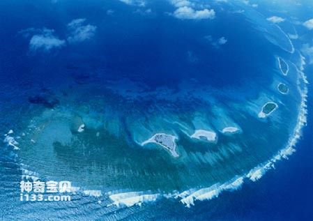
A bird's eye view of the Paracel Islands in the South China Sea - Qixing Island
The South China Sea is located in the south of mainland my country. The South China Sea is bounded by my country's Guangdong, Guangxi, Fujian and Taiwan provinces in the north, the Philippine Islands in the southeast, Vietnam and the Malay Peninsula in the southwest, and the Pumu Shoal in the south is close to Kalimantan Island. The vast South China Sea is connected to the Pacific and Indian Oceans through the Bashi Strait, Sulu Sea and Malacca Strait. It has the largest area, about 3.56 million square kilometers, which is equivalent to 16 Guangdong provinces. The southernmost Pumu Shoal in my country is more than 2,000 kilometers away from the mainland, which is farther than the distance from Guangzhou to Beijing. The South China Sea is also the deepest sea area adjacent to my country, with an average water depth of about 1,212 meters. The deepest point in the central abyssal plain reaches 5,567 meters, which is greater than the height of the Tibetan Plateau on the mainland.

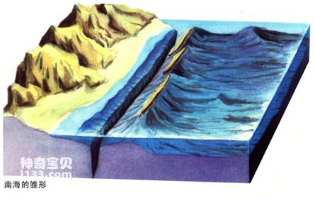
Schematic diagram of sea and land changes in the South China Sea a

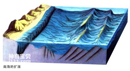
Schematic diagram of sea and land changes in the South China Sea b
The South China Sea is mostly surrounded by peninsulas and islands. Compared with the ocean, the land area is very small. The rivers flowing into the South China Sea are mainly distributed in the north, including the Pearl River, Red River, Mekong River, Chao Phraya River, etc. Because the sand content of these rivers is very small, the South China Sea, with its wide sea and deep water, always appears turquoise or dark blue. The South China Sea is located at low latitudes and is the tropical deep sea with the warmest climate among my country's sea areas. The surface water temperature of the South China Sea is high (25℃~28℃), the annual temperature difference is small (3℃-4℃), the temperature is high and humid all year round, and the summer is long without winter. The South China Sea has the highest salinity (35%) and a tidal range of 2 meters.

The clear waters of the South China Sea
The natural geographical location of the South China Sea is suitable for coral reproduction. On the high platform of the seabed, many beautiful coral islands are formed, such as Dongsha Islands, Xisha Islands, Zhongsha Islands and Nansha Islands. The South China Sea Islands were discovered and developed by the working people of our country very early and are an integral part of our territory. The South China Sea is rich in marine products, including aquarium/sea-cucumbers.html">sea cucumbers, oysters, horseshoe snails, tuna, red fish, sharks, lobsters, barracuda, cuttlefish, squid and other valuable tropical aquatic products.
animal tags:
We created this article in conjunction with AI technology, then made sure it was fact-checked and edited by a Animals Top editor.